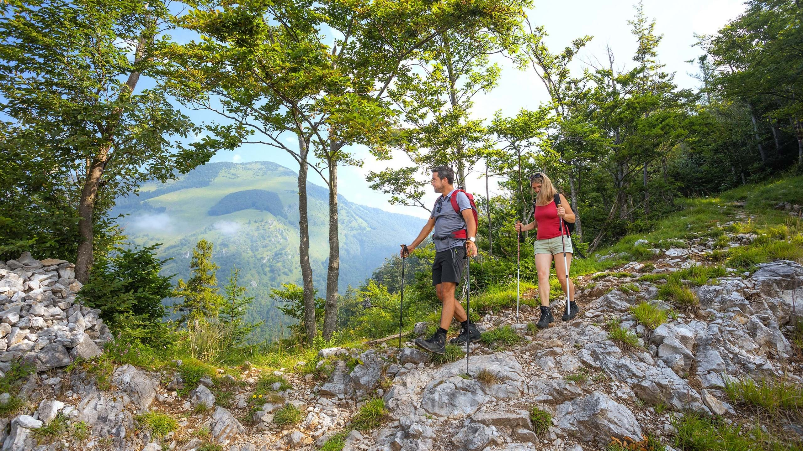
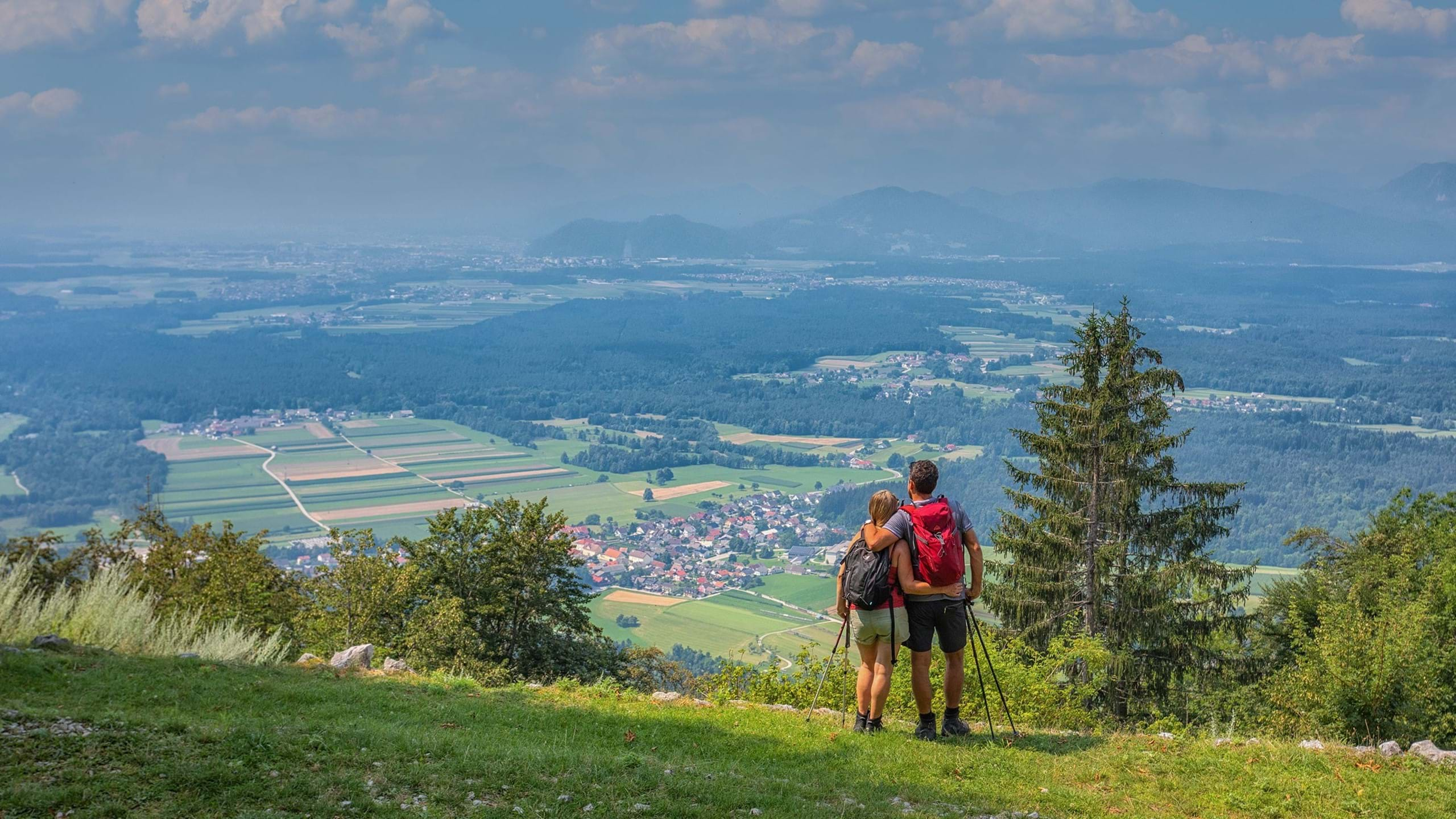
Hikers can choose paths between 500 and a good 2500 meters above sea level. Beautiful views can be reached by anyone on the less demanding trails, while some level of fitness is recommended to conquer higher peaks. We also have enough challenges for well-prepared and experienced hikers and climbers.
")
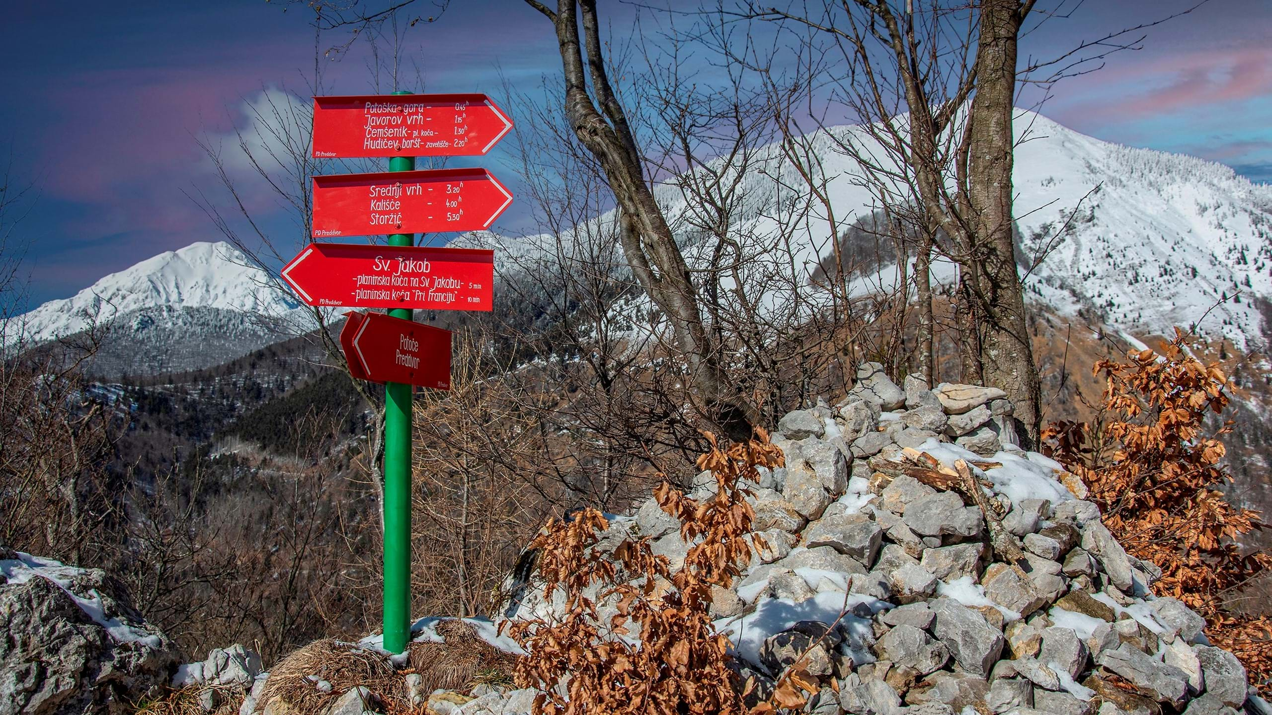
St. Jakob is one of our most frequently visited hills, which offers beautiful views of Storžič, Ljubljana Basin and all the way to Triglav. The excellent service in Mountain hut St. Jakob always provides refreshments and merriment.
")
The ascent to Potoška gora is a pleasant half-day trip. Despite its high location, its dense forest does not allow a scenic view, only a view of Hudičev boršt, Cjanovca and Srednji vrh. Potoška gora's take-off point is extremely popular among paragliders.
")
St. Lovrenc above Bašelj is a popular destination for beginning hikers. Next to the church is a large panoramic meadow. Lovrenc hut is famous for its very delicious bobs, as they call their famous donuts.
")
A visit to the Čemšenik hut does not require much effort, but it is a great walk to free the minds of all family. It is known for friendly caregivers and really great food. It is a popular starting point for quite a few easily accessible tours to the surrounding peaks.
")
If the way home was just a warm-up for you, we recommend that you take the path to Javorov vrh, with a magnificent view of the valley, Cjanovca and the Kamnik-Savinja Alps.

This circular path will lead you through the isolated forest and lonely pastures, where you will hardly meet a crowd of hikers. The trail is suitable in all seasons, it is not recommended only during newly fallen and soggy snow.
")
Two farmers quarreled over the ownership of the forest and one of them shouted, "Let the devil take it!" The devil grabs the forest and runs with it. When the churchbells of St. Jakob announce the dawn, the devil drops his burden in the middle of the hill. This is the legend about the creation of the intriguing forest patch.
")
Bašeljski vrh is an easily accessible mountain that stretches between Storžič and Mali Grintovec. At the top are benches with a beautiful view of the Sava Valley, the Julian Alps and the highest peaks of the Kamnik-Savinja Alps.
")
Srednji vrh is the highest in a group of rounded peaks located east of Storžič. They are very similar in height and generosity with views and where you can enjoy true mountain tranquility. The top is easily accessible, but still requires a significant fitness level.
")
Mali Grintovec is lower than Srednji vrh, but it still requires a significant fitness level. The whole ridge offers an mountaineering tour with altitude differences, which even experienced mountaineers are proud to conquer.
")
Storžič is one of the most visited 2,000-meter peaks in Slovenia, but is not an easy task to conquer. Caution should be taken in wet weather and winter conditions. There are quite a few paths leading from Preddvor, this time we took the village of Bašelj as a starting point.
")
Storžič is calling you for a visit with all its might. From Preddvor there are a few starting points for conquering this peak. We strongly recommend that you check the weather conditions, make sure you have the appropriate equipment and a suitable fitness level.
")
Suhadolnik is the most convenient starting point for visiting the peaks, which overlook the valley of the river Kokra. The trail is suitable for experienced mountaineers.
")
Grintovec is the highest peak in the Kamnik-Savinja Alps and is extremely attractive for all mountain lovers. There are quite a few height differences from the Kokra valley, so it requires a reasonable fitness level, unless you sleep in Cojz hut and conquer the top the next day.